Table of Contents
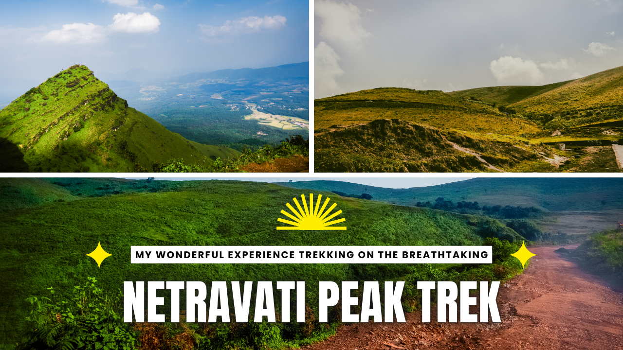
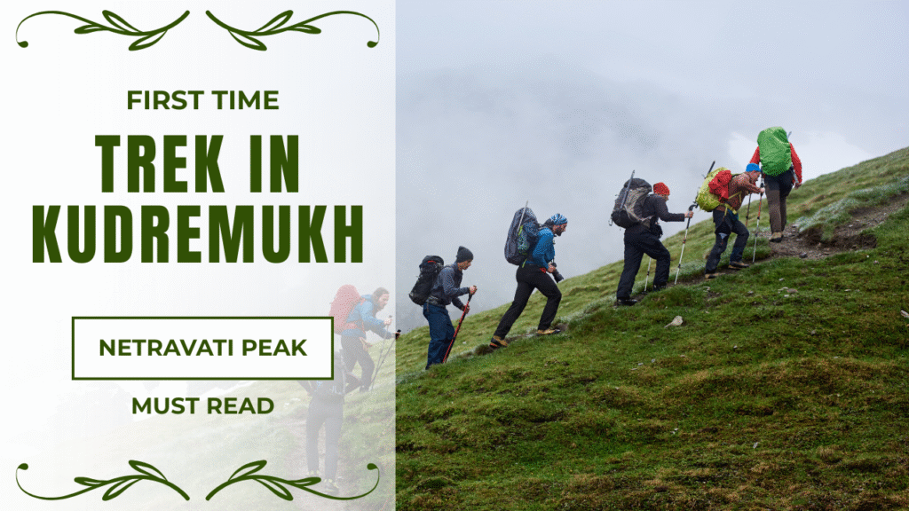
The Netravati Peak trek is located in Chikmagalur’s Kudremukh National Park. Its elevation stands at 1,520 meters. The trail is a 14-kilometer return trip. The route goes through the jungle, open lands, and brooks. The visitors have to pay entry fees of ₹500. They will be required to sign the agreement online and get a guide. The trek starts at Samse, 60 kilometers away from Mangalore and 300 kilometers from Bangalore. Normally, people complete the 4-6 hour-long hike in one day. However, people who walk slower might take two days.
| Attribute | Details |
| Location | Kudremukh National Park, Chikmagalur, Karnataka |
| Elevation | 1,520 m (4,986 ft) |
| Trek Distance | ~14 km round‑trip |
| Netravati Peak Entry Fee | ₹500 per person |
| Best Season | June–February (pre/post‑monsoon & winter) |
| Trek Time | 4–6 hrs round‑trip |
| Nearest Town | Samse (trailhead) |
| Nearest Airport | Mangalore (60 km) |
| Permit Required | Forest department registration & guide |
Geographic & Ecological Context
Netravati is located in the Western Ghats, a UNESCO World Heritage Site that houses diverse botanical and zoological species. The way to the peak is through the green forests, some open areas of grass, and meandering streams. Walkers can spot uncommon species, including the big Malabar squirrel, and hear birds whistling like the Malabar whistling thrush.
Be careful of the earth and especially look out for leeches. Folktales claim the Netravathi River, which begins from the peak, has magic, making people imagine the place is endowed with the unseen world. The supernatural stories lend the district a hallowed shade for lots of tourists.
Key Facts Netravati Trek
Height and Top View
Netravati is approximately 1,520 meters above sea level. It occupies one of the highest peaks in Chikmagalur. The Western Ghats Mountains create a panoramic view from the top of the peak. Some days, visitors might even be able to spot Kudremukh Peak (1,894 meters) and Netravathi River below.
Starting Point and Climb
This 900-meter Samse village is where the hike kicks off. At about 620 meters, climbing is required to reach the summit. This trail crosses through forests, grasslands, and rocky ground. A break is enough for people of average fitness to do this climb, but they will be a little tired at the end.
Trail Length
The Netravati Peak distance for a round trip is approximately 14 km. Some trekkers estimate it as 12 km, depending on the final point they reach near the summit.
How Hard Is It?
The hike is easy to mildly hard. No special equipment is required, but some sections are steep and slippery when wet. This is a good idea for those new to romping to practice, say walking around the park, before you make this your trial run. Tolerable shoes and regular breaks are two things that can make it:
Cost and Guides
The entrance will be 500 rupees per person. One can pay this at Samse’s forest check-post. The guide has to be present during the entire tour, and you must pay around 1,000 rupees for 12 people. If you hire them, they will care for all of you and earn money for the locals.
How to Book
The Netravati Peak booking online can be done through the official Karnataka Forest Department portal. Don’t forget to complete the Netravati Peak registration online and carry a soft/hard copy of your permit before the trek begins.
How Long Does It Take
Generally, it takes 4-6 hours for the whole journey. Young people without difficulties usually spend 5 hours with very brief breaks. Starting ot 6 a.m. is a good idea because the park does not close until 2:30 p.m. You should walk faster in the dry months than in the rainy months.
Best Time to Visit
The best time to visit is from June to February, when everything is clear. The sky is always blue and there are no rain showers. June and September bring spring green life, making paths very slippery for hikers and stirring the air that brings out leech parasites.
How to Get There
From Mangalore to Netravathi Peak, the distance is around 60 km. You can take a taxi or a bus to Kudremukh town and then continue toward Samse. However, it is just about 60 km from Kadur Railway Station.
If you take a taxi or bus from there, you will arrive in Sames. Bangalore, again, is a distance of 300 km, and you can get there by road. Start your trip with a shared jeep from Samse to where the trek will commence.
Park Rules
After climbing 6 from am to 6 pm, the entrance is closed at 8:30 pm at the Amse checkpoint. Note that sleeping at Kudremukh National Park is not allowed. The park authorities just say the tents could be put up in the nearest places to stay. Besides this, always take your permit, ID, and a guide while hiking.
Permits, Fees, and Safety Rules
Do not forget to obtain a forest permit online before you go. Remember to bring the PDF copy with you. The fee at Netravati is 500 rupees per person. With experienced guides, trekking through dense forests might not be that difficult. Guide fees are usually 1,000 rupees for 12 people at max. Staying at the park is not permissible. Stay at the local homes in Samse or Kudremukh town instead.
Getting Ready for the Trek
Fitness level: A bit challenging. Be ready to walk a distance of 14 km and climb up to 600 meters.
Important Things to Bring:
- Durable hiking boots with thick soles and a good grip
- Walking sticks for help on slippery parts, and use them as a staff
- Put on a raincoat over your clothes because they have to be water-resistant
- First-aid kit and spray to scare away the leeches
Health Tips:
Keep rehydrating your body. Make frequent stops. Going on a new hike this late is strictly forbidden, as the park closes at 2:30 pm.
Netravathi Peak Photos
How to Reach the Trailhead
| Origin | Distance to Peak | Travel Mode |
| Bangalore | ~300 km | Drive via Hassan–Mudigere–Samse (~6 hrs) |
| Chikmagalur | 35 km | Taxi/bus to Balur + jeep/walk to Samse |
| Mangalore | 60 km | Taxi/bus to Kudremukh town, then Samse |
Samse is the place where a lot of people usually begin their journey. Most visitors get there by shared jeep, which costs about 250 rupees per person. A few of them, however, prefer to walk 4 km to the base checkpoint. These jeeps leave at the rise when the park opens.
Route and Distance
The walk to Netravati is a 12-16 km journey there and back. The start of the path is at 900 meters high and will take you through a few different terrains:
- The first three km: Dense forest
- The next four km: Crossing brooks and walking on the fields of grass
- The last five km: Climbing the hill through the rocks
Warnings are identified through signs and stone piles. However, when it rains excessively, it becomes very hazy. Therefore, one must have either a compass or GPS as a precaution.
Best Time to Visit
June to September
Fresh atmosphere, rivers are full. Be careful, the rocks are very slippery and there can be many leeches.
October to February
Normally sunny, drier paths, a comfortable climate with cool wind. Great places for panoramas and photos.
March to May
Scorching, dry, and off. Hence, not preferable for visits.
Where to Stay and Eat
- Homestays around the peak are priced at 800-1,200 rupees a day.
- Only vegetarian home-cooked meals are served in these places.
- Samse village has small stores for basic snacks.
- Clean water from brooks can be collected. Carry water purification tablets in the off-season.
Two-Day Trip Plan
Day 1
- 10 PM: Leave Bangalore
- Dawn: Arrive at Samse village
- Morning: Take the shared jeep to the start point
- Afternoon: Walk 6 km to camp or homestay
- Evening: Meet guide, eat dinner, prepare for next day
Day 2
- 5 AM: Start climb to peak
- Morning: Reach peak, enjoy the view, return to Samse
- Afternoon: Visit Kadambi Falls and Hanuman Gundi Falls
- 3 PM: Leave Samse
- Late Evening: Arrive in Bangalore
The plan allows enough time to rest, take photos, and walk at your preferred pace.
Places to Visit After the Trek.
- Kadambi Falls: 22 km away. A waterfall in Kudremukh National Park. Nice for a swim.
- Hanuman Gundi Falls: 22 km away. A two-step fall. Easily accessible on foot. The fee for tourists is Rs. 100.
- River Rafting: It is now possible on the Netravathi River after the rainy season ends.
Conclusion
Netravati trek lies in Kudremukh National Park, which offers a trek on a winding road through different ecosystems. Hikers can have abundant, beautiful views and rich vegetation while remaining safe through careful planning, maintaining their fitness via regular exercise, and putting safety measures in place. The trek demands the use of the internet, a certified climbing instructor, and adherence to park rules. Ecology service trip combines natural beauty, adventure, and cultural immersion, rendering it an unforgettable journey for nature fans.
Frequently Asked Questions
Do I need a guide for the trek?
Yes, a certified guide is mandatory per forest regulations.
Can I camp inside Kudremukh National Park?
No, camping is banned; stay at homestays in Samse or nearby towns.
How fit should I be for this trek?
Moderate fitness; first‑time trekkers can complete in 4–6 hrs with breaks.
